Hypsometric maps represent the elevation of the terrain with colors. The area between two neighboring contour lines receives one specific tint. In this map of Tajikistan, the darker the color the higher the elevation.
Perfect example of a PLSS map and its use in planning and understanding the townships around the region. This is in New Mexico and the county of Valencia which is located in the middle of this map and around the city of Albuquerque
This is another map of the Island of Hawaii, and specifically a thermatic map describing the different land reserves on the island and how they are divided up through the varous federal and state run departments.
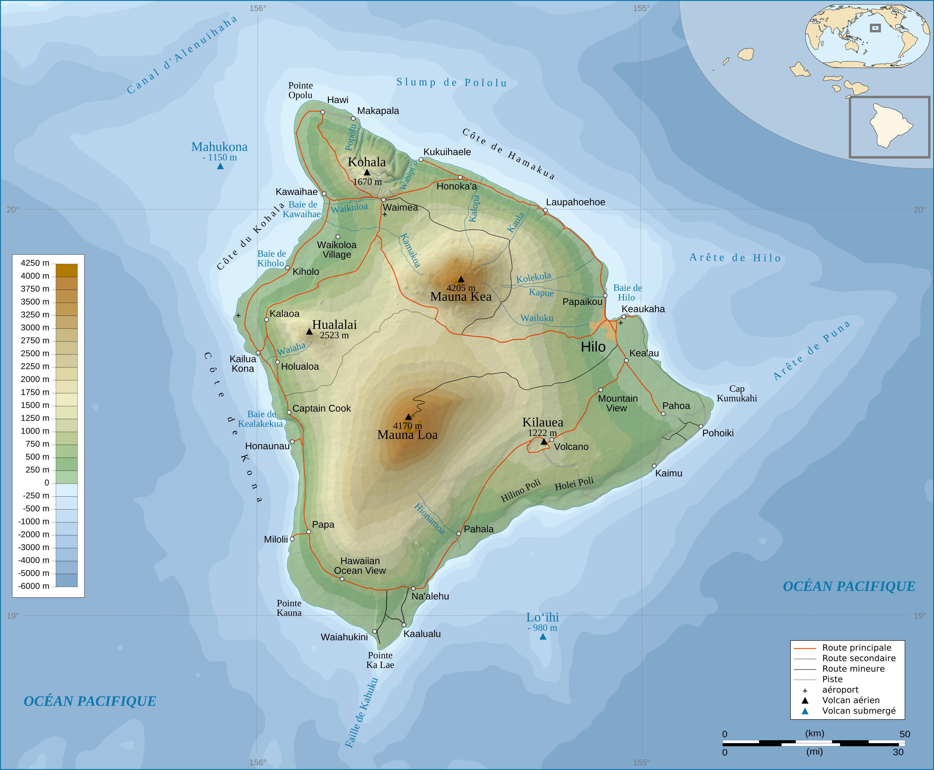
This is a topographic map found on Wikipedia and shows the Island of Hawaii. The Interesting thing about this map is that it shows the togography of the terran from sea level and above. However the bathimetric maps would show a much different look of this massive sheild volcano. http://en.wikipedia.org/wiki/File:Hawaii_Island_topographic_map-fr.svg
 One dot = 7500 people

![[Hypsometric+map.jpg]](https://blogger.googleusercontent.com/img/b/R29vZ2xl/AVvXsEhmyDjvgbRpJZhaWJR3vcvNDslpL8rNMZvtE69DPL69AxpG2EybmDxeGjvSfAYx4iRm62xObwh7VFHEkuwldsTZDlFX8v9ckp-DFiUOef78YvHM-d1LcIixAYH8vu9vovf_hSfVnl_yIYt4/s1600/Hypsometric+map.jpg)